What to Expect: the Trail & Terrain
Interested in hiking the Voyageur Trail, but you are not sure what to expect? Here are some answers to the most frequently asked questions.
Looking for Hike leadership courses. Contact info@ voyageurtrail.ca or Hike Ontario directly on their website.
What to Expect - The Trail
The Voyageur Trail is a pedestrian trail only–this means that it is made for hiking, backpacking, snowshoeing and bushwhack skiing (registered with the Trans Canada Trail for only these uses). If the trail is on private land, the landowner has only been asked for permission for pedestrian uses only and we ask that you respect the landowner’s wishes at all times.
In most places, the trail is too rough for other uses anyway. Where trees have fallen completely to the ground and lie there across our path, more frequently than not, we climb over it. We cross streams on beaver dams, rocks or logs. There are no facilities along the Voyageur Trail. This is why we advertise it as a “true wilderness trail”. No matter what kind of physical shape you are in, you can expect to do approximately two (2) kilometres an hour on the Voyageur Trail. Plan your outing taking this into account. Some hikers have described it as “bushwhacking with blazes”, and in some areas, this description is true.
You can expect to see wildlife along our trail. In Northern Ontario, the largest animals you can see include moose, wolf and black bear. We ask that you respect all wildlife you may encounter. It is THEIR home and WE are the visitors! You would do well to remember that. If you plan on camping at any of the designated campsites, please hang all your food and anything which has a smell to it in a bear bag. This is a tree branch located a distance from your tent at least 10 feet off the ground. If a bear visits your campsite during the night, it will go after your bear bag and not your tent!
Most animals are interested in smells of any kind. You would be wise to use deoderants, shampoos and soaps with no scents added to them. Bear sprays are made from pepper and are designed to work only if you spray the mixture right into the bear’s eyes. Do NOT try to use them as a repellent. If you spray anything with bear spray, it will attract bears, not repell them. They like to lick the pepper! Also, your bear spray can should be stowed with all the other things in your bear bag at night as it will attract them to your tent if they catch a whiff of the pepper in the can. Not only will these scents attract bears, but flies as well. June is usually the worst month of the year for black flies in the Northern Ontario bush and they usually begin around the long weekend in May. July is the favourite month for mosquitoes. Horse flies usually start in July.
If you hike in the spring or fall to avoid fly season, be forewarned that spring runoff will swell streams and rivers until May. This may make crossings more difficult.
Fall is a great time to hike, but remember that evenings are cold and daylight hours are short. Don’t get caught out after dark and it can get dark very fast in the fall!
When the trail is cleaned, we make sure that blazes are in place and can been seen from a distance. This means that blazes are replaced and branches interfering with seeing those blazes are clipped back. That is our number one priority on a trail maintenance outing. Old blazes are painted on the tree, which can make them hard to find. Newer blazes are made out of scrap pieces of white vinyl siding. They are nailed to trees using aluminum nails so if the tree is ever harvasted in the future, the nails will slice through and won’t hurt anyone employed at a lumber mill. As you pass a blaze, you should be able to see the next one.
Sometimes branches or downed trees can obscure blazes and it may take a while to pick up the trail again. We would appreciate hearing from anyone who finds this situation so trail maintenance crews can be sent out to remedy the situation.
A double blaze indicates a sharp turn in the trail.
White blazes indicate the main trail, blue indicate a side trail to a point of interest or an access, and yellow blazes indicate a loop trail.
On rocky outcrops where there are few trees to blaze, we build cairns of rock to mark the route.
Above: a new vinyl blaze is put in place. A good example of an old painted blaze
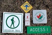
Samples of various blazes you may see at an access point.
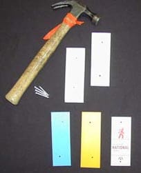
White blazes indicate the main trail, blue blazes indicate a lookout trail, or access trail and yellow blazes indicate a loop trail.
National trail blazes are found from time to time along the trail.
On trail parties, we also try to clip small tree saplings on and near the trail to keep the forest from regenerating over our path, however, we do not bother with rapid annual growth such as raspberry canes, ferns, etc. When the tree canopy is cut back (for instance, when logging has taken place, or along road access points) the direct sunlight will encourage growth along the forest floor. Raspberry canes and ferns will grow back very quickly if they are clipped, which wastes a lot of time for a few people planning on cleaning a length of trail in any given day. The main focus is to keep people from getting off the trail (blazes) and keep trees from growing up in the middle of our path. The end result of all this to a hiker, is that in sections that are not well used, the “path” may be obliterated by ferns and other vegetation. If you do not see a “path” on the ground, follow the blazes very carefully. It is easy to get off the planned route if you are pushing your way through five foot high ferns!
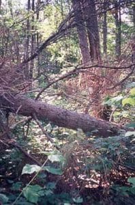
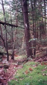
These two photos were taken before and after a trail maintenance outing on the same piece of trail. We usually re-route around large downfalls across the trail.

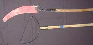
Handtools are used on work parties.
If you decided to go out on a trail maintenance outing with an organized club, you would be shown how to use these tools and would only use the tools you were comfortable handling.
What to Expect Part Two - Terrain
The Voyageur Trail Association (VTA) wishes to remind you to watch for blazes to stay on the trail. Some of our trails can become difficult to navigate where active clubs do not exist. Members are advised to download the desired trail maps in the Ondago app before leaving home. These will work offline and show your location along the route, greatly enhancing your safety particularly on lesser-used portions of the trail.
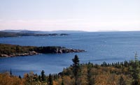
From Blind River west to Sault Ste. Marie, the Voyageur Trail runs roughly parallel to and between 6 to 15 kilometres north of the Trans Canada Highway. The only town the trail runs directly through (for provisions) is Iron Bridge. You typically must travel several kilometres south along various access roads to reach towns where reprovisioning can take place.
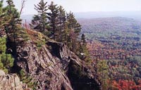
These sections are inland from Lake Huron. It is rugged with hills, streams, rivers and inland lakes (see photo). On all parts of the trail we recommend a water filter or purification tablets. You can look forward to much peace and quiet. The overlooks are usually over inland lakes and rivers, or vast tracts of trees. It is not highly-used and is less-well maintained in places.
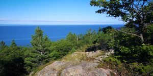
If you plan on travelling through the Echo Ridges section through the Garden River Reserve, just east of Sault Ste. Marie you should obtain permission from the Garden River Band Office (tel. 705-946-6300 for details).
In the immediate Sault Ste. Marie area, the trails are better used and cleaned, therefore, a little easier to follow. There are numerous access points allowing hikes from one to several hours long. There are several loop trails in the Sault Ste. Marie area (yellow blazes) in the Gros Cap (highest hills in the Saulteaux section), Creek Rd. and Hiawatha Highlands areas. There is a 9.6 kilometre long blue-blazed side trail (the Tom Allinson Spur Trail) which leads from the trailhead near Gros Cap to the shoreline of Lake Superior in Red Rock. The Saulteaux Club is one of several Voyageur Trail Clubs that plan outings on the Voyageur Trail in all seasons. Outings are a great way to discover and learn what you can expect on the Voyageur Trail.
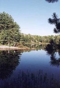
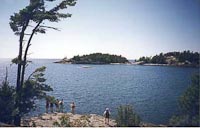
The Goulais, Stokely and Harmony Sections, located immediately west/north of Sault Ste. Marie may not be as well used as the Saulteaux section and therefore may be a little harder to follow due mostly to the annual growth of ferns and raspberry canes. Although the trails are inland from the Lake Superior coastline, there are some spectacular views from the top of King Mountain and Robertson Cliffs and lookouts over Havilland and Harmony Bays. Stokely Creek Lodge (a world class cross country ski resort) operates in the area and has many ski trails crossing the Voyageur Trail.
The Lake Superior Provincial Park Coastal Trail (not maintained by the VTA) is aptly named. It follows the coastline of Lake Superior and that means rocks! Big rocks, medium rocks, little rocks and some sand beaches, usually at the mouth of rivers. Rocks can be treacherous when wet. Keep this in mind. A simple turned ankle can endanger your life while you wait for someone to come along to rescue you. You are right on the shoreline of Lake Superior with all of its many moods. Crashing waves, fog and wind are sometimes the order of the day, but you are rewarded with fine (but usually cold) swimming and an endless supply of water! There are park fees for hiking all Provincial Park trails.
The Michipicoten Section near Wawa has some beautiful overlooks (see photo to left) and waterfalls, however, it is less-well used and may be
overgrown at times. The southern portion of this section is in Lake Superior Provincial Park, and is the responsibility of park work crews. In some years maintenance has not been performed, so check with the Park or the VTA for current trail conditions. Note, if the description and map shows beautiful overlooks, this means climbing is on your agenda.
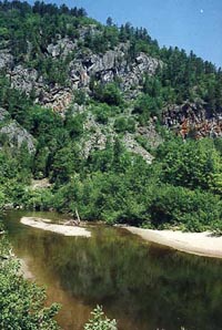
The Coastal Trail in Pukaskwa National Park is a beautiful, well-used backpacking trail. There is only one entrance, at the northern tip (Hattie Cove) and you must register with the Park staff before using the Coastal Trail. This is for your own good, as if you don’t return at the reported time, the park will launch emergency personnel to find you. It is a good introduction to Northern Ontario hiking because of this registry system. It takes approximately 7 days of hiking to reach the southern tip of the Coastal trail and then you have to get back!
The Group of Seven Trail Section follows on or near the coastline of Lake Superior from Heron Bay, through the town of Marathon and beyond. It commemorates the famous artists who frequented the area to paint some of their iconic landscape paintings. The smooth shoreline rocks on this trail are treacherous when wet.
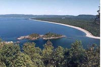
The Casques Isles section of Voyageur Trail near the towns of Schreiber, Terrace Bay and Rossport is over 50 kilometres of trail, encompassing high cliffs affording spectacular lookouts, beaches on Lake Superior and inland scenes. It is rugged but worth the effort. It also passes through Rainbow Falls Provincial Park. The Casques Isles Voyageur Trail Club offers many outings during the year.
The most westerly part of the Voyageur Trail is the Nor’Wester Section, in the Red Rock-Nipigon area. It includes the Nipigon River Recreational Trail (not maintained by the VTA), the Deer Lake Mountain Loop Trail, and the Makukama Falls Loop Trail. Each offers climbs to spectacular lookouts over Nipigon Bay and inland lakes.
You may wish to visit the individual trail section site pages to see more photos in their photo galleries of the types of terrain you may see on any given piece of Voyageur Trail.
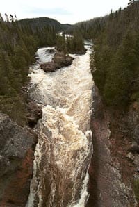
In summary, the Voyageur Trail offers something for everyone. From inland, peaceful lakes and rolling hills to the breathtaking cliffs of the western sections. It is not recommended to hike alone on ANY section of the Voyageur Trail. Always let someone responsible know where you are going, your route and your expected time of return.
Carry enough to ensure that you can survive at least one night in the bush if the fates turn against you. A Voyageur Trail map and description (e.g., the Ondago app, and backup battery power) is a must and we recommend a satellite communication device along with topographical maps and a compass. On many parts of the trail, a cell phone will not work as there is no network coverage. Do not rely on this as your emergency equipment! Be aware of hunting seasons and dress in bright colours to not only be seen easily by hunters but also by rescuers should you require help. Be aware that three of anything is a call for help–three whistles, three fires, etc. Northern Ontario bush demands respect. The Voyageur Trail is a primitive, wildland trail in rugged country. For the most part, there is little trail traffic, and no nearby facilities, therefore you must be self-sufficient! It is the safe hiker who is the good hiker.
Visit the Trail Conditions section on each web page (sorted by location on this website) to find out when the last time your intended route was cleaned, and please report back to us after your trip so we can better plan our trail maintenance work.
From the Voyageur Trail Association, happy hiking!Blin
Don't forget to take these...
Here’s a couple of web site to visit to learn more about being safe in the wild:
Search and Rescue Volunteer Association of Canada: http://www.sarbc.org
Ontario Search & Rescue: http://osarva.nt.net
