saulteaux - Sault Ste. Marie area
links to trail sections that we manage:
club contact:
![]() saulteauxpresident@voyageurtrail.ca
saulteauxpresident@voyageurtrail.ca
Saulteaux Club President – 705-254-2356
Feel free to contact us regarding trip planning. Saulteaux Club members receive occasional email updates from the Club President.
Follow us on Facebook for information regarding upcoming outings and maintenance hikes.
![]()
Scroll down for more Club information.
Maps for the saulteaux Section
Harmony bay - Sault Ste. Marie - thessalon
Interactive Web Map (overview of all trail maps for Clubs of the VTA): CLICK HERE
This map shows the full extent of the completed sections of Voyageur Trail.
It is not intended for hiking purposes. The zoom level is restricted
and it does not contain any descriptive information.
From this page you can also view our whole suite of mapping products.
Members of the VTA have full access to these products,
plus they receive an Access Code for our digital maps on the Ondago App.
To purchase your membership, CLICK HERE
Immediately upon receipt of payment members get access (downloadable instructions) to the latest map products covering close to 500 km of trail.
![]()
Only the official maps and route descriptions from the Voyageur Trail Association on the Ondago app are accurate, reliable and trustworthy.
club updates and other important information
Thank you for your patronage over the past hiking season!
As conditions dictate, some small sections of the trail will be open for snowshoeing.
Email or message us for more information.
Saulteaux-Goulais Section:
Goulais trail – Hwy 552 and Jewelweed Loop closure
The Jewelweed Loop is permanently closed
Harmony-Stokely Section:
Parking at Tier Lake / Havilland Lookout Access
Parking is permitted at McCauleys Motel to access the VT on the Tier Lake Spur Trail. Just let the owners know.
Trail Closure: The 1.9 km of trail from Old Mill Bay (most northerly part of the Harmony Section) south to where the main trail meets the blue side trail to Eagles Ridge Lookout is permanently closed.
Echo Ridges Section:
Trail Closure: Access 9 and portion of the main VT near Peter Lake closed until further notice.
Logging and road building operations have begun again in this area. Logging trucks will be using the VTA Access 9 trail and harvest operations are underway in the area of Peter Lake in the Echo Ridges Section.
trail sections that we manage:
Harmony-Stokely Section (2 segments + 4 loop trails)
- The Harmony-Stokely section comprises 20 km of main linear trail, 7 km of loop trails, and 10 km of side/access trails. Divided into manageable-length day-trip segments, these trails can be enjoyed from the Harmony Bay area to Robertson Lake Rd.
- The Harmony-Stokely Section passes through an intriguing forested landscape that includes many scenic vistas, lakes, creeks and rivers in the Havilland Bay and Harmony Bay areas. Highlights include King Mountain, Robertson Cliffs, Tier Lake, and stunning lookouts over Lake Superior and the surrounding landscape. The terrain is rugged, with significant elevation changes, all rewarded by magnificent views.
- Harmony-Stokely trails are classified as difficult, with numerous steep climbs. These trails are maintained by volunteers-at-large and local members.
- BEFORE YOU SET OUT:
All outdoor activities involve some degree of risk. Please, remember that your safety is your personal responsibility. So, be well prepared for your chosen activity and route. Let someone know where you are going and when you plan on being back. Make sure to bring adequate food and water with you for your hike. If you plan to venture off the trail system, make sure you have a compass and a map of the area. - Wear proper footwear, dress for the weather and bring enough water and food for the planned hike.
Saulteaux-Goulais Section (6 segments + 9 loop trails)
- The Saulteaux-Goulais section comprises 40 km of main linear trail, 26 km of loop trails, plus 15 km of spur/acccess trails. Divided into manageable-length day-trip segments, these trails can be enjoyed within a 30 minute drive of Sault. Ste. Marie.
- The Saulteaux-Goulais Section passes through an intriguing forested landscape that includes many scenic vistas, lakes, creeks and rivers in and around Sault Ste. Marie. Highlights include the Lake Superior shoreline, the Prince Wind Farm Project, Root River, Crimson Ridge, McIntyre Lake, Hiawatha Highlands and Mabel Lake. Numerous access points lead to Sault Ste. Marie’s north bluffs with views over Lake Superior and the St. Mary’s River, eastward to Mabel Lake and on the south side of the Goulais River valley.
- Saulteaux-Goulais trails are classified as moderate or difficult. These trails are maintained by the Saulteaux Voyageur Trail Club, supported by its members.
- BEFORE YOU SET OUT:
All outdoor activities involve some degree of risk. Please, remember that your safety is your personal responsibility. So, be well prepared for your chosen activity and route. Let someone know where you are going and when you plan on being back. Make sure to bring adequate food and water with you for your hike. If you plan to venture off the trail system, make sure you have a compass and a map of the area. - Wear proper footwear, dress for the weather and bring enough water and food for the planned hike.
Echo Ridges Section (4 segments)
- The Echo Ridges trail section comprises 56 km of main linear trail and two short side trails. The trail runs between Mabel Lake on the Sault Ste. Marie city limits to Tower Lake (Lonely Lake Rd.). The linear trail is broken down into four segments that can be hiked (in whole or in part) either as out-and-back outings or as through-hikes by walking back along roads or parking a vehicle or bicycle at the other end. This trail passes through the Garden River First Nation, where a vehicle access road pass, issued by the Band Office, is required.
- The Echo Ridges trail section passes through an intriguing forested landscape that includes many scenic vistas north of Echo Bay. It passes Maud Lake, Echo Lake, Wahbunose Lake, Two Horse and One Horse Lakes, Wilson Lake, Peter Lake and numerous rivers and creeks. The terrain is rugged, but without significant elevation changes. This is perhaps the most remote section of the Voyageur Trail system, with longer trail segments and more limited access, especially in the western portion of the trail.
- Echo Ridges trails are classified as difficult. These trails are maintained by the Saulteaux Voyageur Trail Club, supported by its members.
- BEFORE YOU SET OUT:
All outdoor activities involve some degree of risk. Please, remember that your safety is your personal responsibility. So, be well prepared for your chosen activity and route. Let someone know where you are going and when you plan on being back. Make sure to bring adequate food and water with you for your hike. If you plan to venture off the trail system, make sure you have a compass and a map of the area. - Wear proper footwear, dress for the weather and bring enough water and food for the planned hike.
Desbarats-Huron Shores Section (9 segments)
- The Desbarats-Huron Shores trail section comprises 77 km of main linear trail and 15 km of side trails between Tower Lake and the village of Iron Bridge. The linear trail is broken down into nine segments that can be hiked (in whole or in part) either as out-and-back outings or as through-hikes by walking back along roads or parking a vehicle or bicycle at the other end.
- The Desbarats-Huron Shores trail passes through an intriguing forested landscape that includes many scenic vistas, lakes, creeks and rivers between Tower Lake and the village of Iron Bridge. Highlights include Ottertail Lake, Shaw Dam Lake, Tea Lake, Basswood Lake, and the Mississigi River valley. A 15 km side trail leads into Bruce Mines, and the trail passes north of Desbarats and Thessalon. Trail users are taken through the Kirkwood Forest which was planted as a land reclamation project beginning in the late 1920’s. Numerous historic roads through the area allow access for forestry activities, and portions of the trail follow these roads.
- Desbarats-Huron Shores trails are classified as moderate or difficult. These trails are maintained by the Saulteaux and Penewobikong Voyageur Trail Clubs, supported by their members and volunteers-at-large.
- BEFORE YOU SET OUT:
All outdoor activities involve some degree of risk. Please, remember that your safety is your personal responsibility. So, be well prepared for your chosen activity and route. Let someone know where you are going and when you plan on being back. Make sure to bring adequate food and water with you for your hike. If you plan to venture off the trail system, make sure you have a compass and a map of the area. - Wear proper footwear, dress for the weather and bring enough water and food for the planned hike.
club information:
The Saulteaux Club maintains a blog on a separate website. Open the Saulteaux blog (in a new tab).
Here’s a little Saulteaux (pronounced Sue-toe) Club history…
- first section built: Maki Road to Goulais Avenue on November 23, 1974
- whole section officially opened on September 21, 1975 at a ceremony at Gros Cap before a crowd of approximately 150 people
- first New Year’s outing was held in 1975
- helped to establish the Sault Trails Action Committee (STAC) to plan and build the SSM HUB Trail.
The trail is maintained entirely by volunteers and most of the trail is located on private land. The Saulteaux Club would like to acknowledge both the volunteers and the landowners who make the Trail such a valuable recreational asset to our community
The Saulteaux Voyageur Trail Club schedules many public outings a year including hikes, trail maintenance, snowshoes, and occasionally bushwhack skiing. We schedule several outings a year for small children and/or beginners. If in doubt, call the leader. He/She will be most willing to let you know how long you can expect to be out and what kind of terrain you may be covering. Then decide if that particular outing is for you. Come out and try us out! You are more than welcome!
The Saulteaux Section does outings in all seasons…enjoy the trail on foot…on snowshoes and skiis! We also explore area waterways (the original “voyageur trails”) in kayak and canoe.
Saulteaux Club Outings (outside of Sault Ste. Marie area are marked with an *)
For all outings, bring water, fly repellent, a lunch, and dress appropriately. Be prepared to sign an Assumption of Risk Agreement. Unless otherwise indicated, these outings are all a Level 2, slow (according to Hike Ontario recommended ratings.) Meeting location addresses: Goodlife building, 589 Second Line East (in parking lot on Second Line side); Market Mall 275 Second Line West (in parking lot near Korah Road corner); Wellington Square Mall parking lot (nearest the corner of Trunk Road and South Market Street).
Check out this 2012 video from Shaw TV about the Saulteaux Club:
Local Information:
Local Links of Interest:
- Agawa Canyon Train Tour
- Algoma’s Water Tower Inn, hotel with pool, sauna, whirlpool, fitness centre, restaurant, bar – ask about the Adventurer’s Club
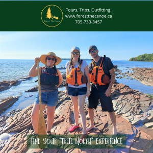
- Blaq Bear – Providing logistical support to hikers
- Bush Plane Museum “Canada’s Best Indoor Attraction ” – Attractions Canada, 2001
- Clean North, environmental concerns
- Fallen Leaves Maple Products
- Prince Township, hiking, golfing, sight seeing, zoo, paintball, etc. a short drive on the way to the Voyageur Trail
- Sault Cycling Club, cycling enthusiasts
- Sault Naturalists, bird watching, plant and insect identification
- Sault Star newspaper, Sault Ste. Marie’s daily newspaper
- Sault Ste. Marie, city site with many other links
- Sault Ste. Marie Canal, a National Historic Park
- Sault Ste. Marie Conservation Authority, landowner for many of our local trails
- Sault Stryders (running club)
- Soo Today.com for Sault Ste. Marie’s on-line up-to-the-minute news
Current Saulteaux Voyageur Trail Club Executive:
Mark Crofts, President
Virve Squire, Vice-President
Ursula Schleen, Secretary-Treasurer
Steve Dominy, Trailmaster
Related Materials:
Trail Sponsors